Geolocate

Kankot topographic map

Click on the map to display elevation.

About this map

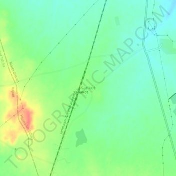
Name: Kankot topographic map, elevation, terrain.

Location: Kankot, Wankaner Taluka, Morbi District, Gujarat, India (22.46827 70.85869 22.50827 70.89869)

Average elevation: 130 m

Minimum elevation: 111 m

Maximum elevation: 163 m

Gear up for your next adventure:

📷Outdoor Action Camera - Capture high-elevation views and rugged adventures
🧢Outdoor Visor - Breathable visor for sunny hikes
Camping Groundsheet - Protect your tent from moisture and dirt
🔥Emergency Fire Starter - Reliable ignition source for all weather conditions
🧢Hiking Sun Hat - Wide-brimmed protection for exposed mountain ridges

As an Amazon Associate, this site earns from qualifying purchases at no extra cost to you.