Geolocate

Montezuma topographic map

Click on the map to display elevation.

About this map
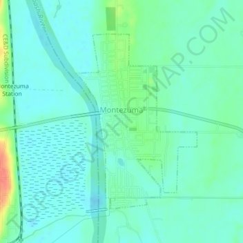
Name: Montezuma topographic map, elevation, terrain.

Location: Montezuma, Parke County, Indiana, 47862, United States (39.78182 -87.37740 39.80126 -87.36217)

Average elevation: 153 m

Minimum elevation: 141 m

Maximum elevation: 192 m

Other topographic maps

Click on a map to view its topography, its elevation and its terrain.
Pin Hook

United States > Indiana > Parke County

Average elevation: 209 m

Gear up for your next adventure:

🧳Compression Sacks - Maximize space in your backpack by shrinking gear
🧤Rechargeable Heated Gloves - Extreme warmth for Canadian winter expeditions
🧥Fleece Jacket - Warm and lightweight jacket for layering
🥾Approach Boots - Comfortable boots for hiking and climbing approaches
⛺Family Camping Tent - Spacious tent suitable for family camping trips

As an Amazon Associate, this site earns from qualifying purchases at no extra cost to you.