Geolocate

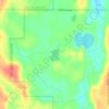
Dresser topographic map

Click on the map to display elevation.

About this map

Name: Dresser topographic map, elevation, terrain.

Location: Dresser, Polk County, Wisconsin, United States (45.34626 -92.65180 45.38303 -92.61610)

Average elevation: 306 m

Minimum elevation: 236 m

Maximum elevation: 369 m

Other topographic maps

Click on a map to view its topography, its elevation and its terrain.
Tula Lake

United States > Wisconsin > Polk County

Average elevation: 353 m

Gear up for your next adventure:

🛁Quick-Dry Microfiber Towel - Space-saving towel that dries rapidly on the move
🧥Fleece Jacket - Warm and lightweight jacket for layering
🎒Hiking Backpack - Lightweight and ergonomic backpacks for day hikes or multi-day treks
🥾Mountaineering Boots - Supportive boots for climbing and high-altitude hiking
🧭Orienteering Kit - Tools for map reading and navigation in the wild

As an Amazon Associate, this site earns from qualifying purchases at no extra cost to you.