Geolocate

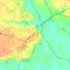
High Point topographic map

Click on the map to display elevation.

About this map

Name: High Point topographic map, elevation, terrain.

Location: High Point, Chesterfield County, South Carolina, 29728, United States (34.73115 -80.45695 34.77115 -80.41695)

Average elevation: 193 m

Minimum elevation: 119 m

Maximum elevation: 224 m

Other topographic maps

Click on a map to view its topography, its elevation and its terrain.

Gear up for your next adventure:

⛺Tent Footprint - Protect tent floor and increase durability
📷Outdoor Action Camera - Capture high-elevation views and rugged adventures
🥾All-Terrain Hiking Boots - Versatile boots for varied hiking conditions
🧥Ultralight Puffy Jacket - Maximum warmth that packs down to the size of an orange
🥘Camping Cookware Set - Compact nesting pots and pans for trail cooking

As an Amazon Associate, this site earns from qualifying purchases at no extra cost to you.