
Campeche topographic map
Click on the map to display elevation.
Campeche
Before the current shield was adopted, there was a process to constitute a shield as an officer. The first project was presented in 1772 before the possible elevation to the title of city of the town of San Francisco de Campeche, when requested by the Cabildo de Campeche in a contest for the election of shield de Armas. The first design was submitted by Juan Antonio Rexo and Peñuelas on September 24 of that year but was rejected on October 17 for not being subject to the rules of heraldry. Ramón Zazo and Ortega subsequently presented three projects; the first two were rejected but finally the third was approved in council on November 7, 1777. The shield was approved by his majesty Carlos III of Spain with the certificate of: "the City Title is granted to the town of San Francisco de Campeche."
About this map
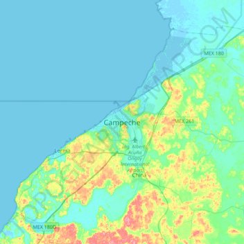
Name: Campeche topographic map, elevation, terrain.
Location: Campeche, Municipio de Campeche, Campeche, 24010, Mexico (19.67812 -90.67983 19.99812 -90.35983)
Average elevation: 18 m
Minimum elevation: -3 m
Maximum elevation: 109 m