Geolocate

Ampayon topographic map

Click on the map to display elevation.

About this map
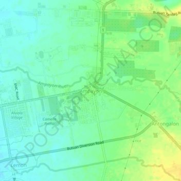
Name: Ampayon topographic map, elevation, terrain.

Location: Ampayon, Butuan, Caraga, Philippines (8.94038 125.58218 8.98038 125.62218)

Average elevation: 17 m

Minimum elevation: 7 m

Maximum elevation: 30 m

Other topographic maps

Click on a map to view its topography, its elevation and its terrain.

Taguibo Dam

Philippines > Butuan

Average elevation: 251 m

Taguibo Dam

Philippines > Butuan

Average elevation: 251 m

Taguibo Dam

Philippines > Butuan

Average elevation: 251 m

Gear up for your next adventure:

🥾Mountain Hiking Boots - High-traction boots for rocky terrain
🥾Trail Hiking Shoes - Durable shoes designed for rugged trails
🔋Lithium AA Batteries - Long-lasting power that performs in extreme cold
☕Camping Coffee Maker - Brew fresh coffee anywhere on the topographic map
🔦LED Headtorch - Bright and durable light for night activities

As an Amazon Associate, this site earns from qualifying purchases at no extra cost to you.