
Make a donation
Gear up for your next adventure:
As an Amazon Associate, this site earns from qualifying purchases at no extra cost to you.
Berwick topographic map
Click on the map to display elevation.
Make a donation
Gear up for your next adventure:
As an Amazon Associate, this site earns from qualifying purchases at no extra cost to you.
About this map
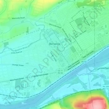
Name: Berwick topographic map, elevation, terrain.
Location: Berwick, Columbia County, Pennsylvania, 18603, United States (41.03842 -76.27108 41.07477 -76.22836)
Average elevation: 172 m
Minimum elevation: 142 m
Maximum elevation: 285 m
Make a donation
Gear up for your next adventure:
As an Amazon Associate, this site earns from qualifying purchases at no extra cost to you.
Other topographic maps
Click on a map to view its topography, its elevation and its terrain.
Grassmere Park
United States > Pennsylvania > Columbia County > Sugarloaf Township
Average elevation: 355 m
Elk Grove
United States > Pennsylvania > Columbia County > Sugarloaf Township
Average elevation: 534 m