
Thank you for supporting this site ❤️
Make a donation
Make a donation
Gear up for your next adventure:
As an Amazon Associate, this site earns from qualifying purchases at no extra cost to you.
Ushguli topographic map
Click on the map to display elevation.
Thank you for supporting this site ❤️
Make a donation
Make a donation
Gear up for your next adventure:
As an Amazon Associate, this site earns from qualifying purchases at no extra cost to you.
About this map
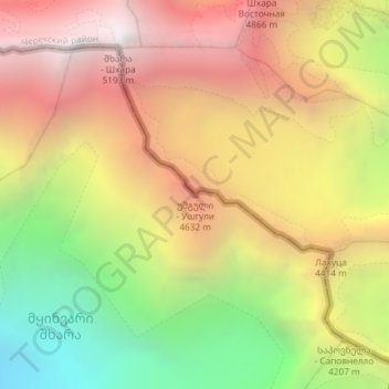
Name: Ushguli topographic map, elevation, terrain.
Location: Ushguli, Mestia Municipality, Samegrelo-Upper Svaneti, Georgia (42.98908 43.12041 42.98918 43.12051)
Average elevation: 4,129 m
Minimum elevation: 2,876 m
Maximum elevation: 5,224 m
Thank you for supporting this site ❤️
Make a donation
Make a donation
Gear up for your next adventure:
As an Amazon Associate, this site earns from qualifying purchases at no extra cost to you.