Geolocate

Darien topographic map

Click on the map to display elevation.

About this map

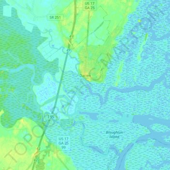
Name: Darien topographic map, elevation, terrain.

Location: Darien, McIntosh County, Georgia, 31305, United States (31.29313 -81.48468 31.43136 -81.37145)

Average elevation: 3 m

Minimum elevation: -5 m

Maximum elevation: 15 m

Other topographic maps

Click on a map to view its topography, its elevation and its terrain.

Gear up for your next adventure:

🥾Trail Hiking Boots - Supportive boots for rough trails
🥾Trail Hiking Shoes - Durable shoes designed for rugged trails
🦶Anti-Blister Balm - Prevents friction and hotspots during long ascents
🥾Waterproof Trail Shoes - Shoes designed to handle wet terrain
👟Leg Gaiters - Keep debris, mud, and snow out of your boots

As an Amazon Associate, this site earns from qualifying purchases at no extra cost to you.