
Thank you for supporting this site ❤️
Make a donation
Make a donation
Gear up for your next adventure:
As an Amazon Associate, this site earns from qualifying purchases at no extra cost to you.
Norco topographic map
Click on the map to display elevation.
Thank you for supporting this site ❤️
Make a donation
Make a donation
Gear up for your next adventure:
As an Amazon Associate, this site earns from qualifying purchases at no extra cost to you.
About this map
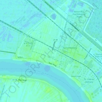
Name: Norco topographic map, elevation, terrain.
Location: Norco, St. Charles Parish, Louisiana, 70079, United States (29.98491 -90.42927 30.01818 -90.38142)
Average elevation: 3 m
Minimum elevation: -5 m
Maximum elevation: 11 m
Thank you for supporting this site ❤️
Make a donation
Make a donation
Gear up for your next adventure:
As an Amazon Associate, this site earns from qualifying purchases at no extra cost to you.
Other topographic maps
Click on a map to view its topography, its elevation and its terrain.
Mimosa Baseball and Tennis park
United States > Louisiana > St. Charles Parish > Luling > Mimosa Park
Average elevation: 3 m