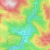
Irati topographic map
Click on the map to display elevation.
Irati
El Irati es un río de Navarra (España), de la zona de Auñamendi, afluente del río Aragón por su margen derecha. Sobre su cuenca está el embalse de Itoiz. Salva un desnivel desde su cota máxima (Pico de Orhi, 2021 m s. n. m.) hasta la desembocadura (395 m) en 88 km de recorrido con una altitud media de su cuenca en los 860 m.
About this map

Name: Irati topographic map, elevation, terrain.
Location: Irati, Oroz-Betelu, Prepirineo, Navarra, 31439, España (42.89197 -1.30361 42.89212 -1.30359)
Average elevation: 746 m
Minimum elevation: 570 m
Maximum elevation: 1,054 m
Other topographic maps
Click on a map to view its topography, its elevation and its terrain.