
Make a donation
Gear up for your next adventure:
As an Amazon Associate, this site earns from qualifying purchases at no extra cost to you.
Memang topographic map
Click on the map to display elevation.
Make a donation
Gear up for your next adventure:
As an Amazon Associate, this site earns from qualifying purchases at no extra cost to you.
About this map
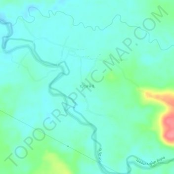
Name: Memang topographic map, elevation, terrain.
Location: Memang, Mondulkiri, Cambodia (12.56150 106.91097 12.60150 106.95097)
Average elevation: 211 m
Minimum elevation: 194 m
Maximum elevation: 277 m
Make a donation
Gear up for your next adventure:
As an Amazon Associate, this site earns from qualifying purchases at no extra cost to you.
Other topographic maps
Click on a map to view its topography, its elevation and its terrain.
Keo Seima Wildlife Sanctuary
Mixed forest types and a range of elevation gives rise to a rich collection of biodiversity, both flora and fauna. A total of 959 plant, fungi, and animal species have been recorded in the area, the highest reported number for any Cambodian protected area. A total of 356 bird species have been recorded,…
Average elevation: 201 m