Geolocate

Delgaditas topographic map

Click on the map to display elevation.

About this map

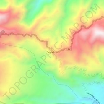
Name: Delgaditas topographic map, elevation, terrain.

Location: Delgaditas, Herveo, Nevados, Tolima, Colombia (5.07874 -75.25622 5.11874 -75.21622)

Average elevation: 2,433 m

Minimum elevation: 2,010 m

Maximum elevation: 2,880 m

Gear up for your next adventure:

🧥Softshell Jacket - Windproof and breathable jacket for hiking
🪑Ultralight Camping Stool - Compact seating for rest stops during long hikes
🧥Ultralight Puffy Jacket - Maximum warmth that packs down to the size of an orange
💧Hydration Bladder - Hands-free hydration solution for long treks
🦟Insect Repellent - Keep mosquitoes and black flies away in wooded areas

As an Amazon Associate, this site earns from qualifying purchases at no extra cost to you.