Geolocate

Katao topographic map

Click on the map to display elevation.

About this map

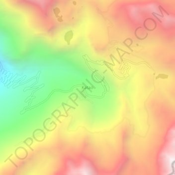
Name: Katao topographic map, elevation, terrain.

Location: Katao, Chungthang, North Sikkim District, Sikkim, India (27.65142 88.79409 27.69142 88.83409)

Average elevation: 4,505 m

Minimum elevation: 3,559 m

Maximum elevation: 5,299 m

Gear up for your next adventure:

🥾Hiking Leggings - Comfortable leggings for outdoor activities
🛶Kayak Accessories - Essential gear for safe and fun kayaking adventures
🧭GPS Outdoor Watch - Smart watch for navigation and fitness tracking in nature
🏕️Camping Hammock - Integrated protection for sleeping between trees
🌬️Windproof Camp Stove - Efficient cooking even on exposed mountain peaks

As an Amazon Associate, this site earns from qualifying purchases at no extra cost to you.