Geolocate

Mondariz topographic map

Click on the map to display elevation.

About this map

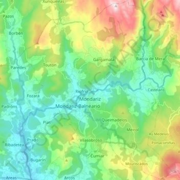
Name: Mondariz topographic map, elevation, terrain.

Location: Mondariz, O Condado, Pontevedra, Galicia, Spain (42.17768 -8.51624 42.30048 -8.34998)

Average elevation: 264 m

Minimum elevation: 17 m

Maximum elevation: 869 m

Gear up for your next adventure:

🔨Vehicle Emergency Tool - Safety tool for remote road trips to trailheads
🌬️Windproof Camp Stove - Efficient cooking even on exposed mountain peaks
🕶️Polarized Sunglasses - Reduces glare from snow and water at high elevations
🧥Thermal Fleece Jacket - Versatile insulation for changing mountain temperatures
🧥Ultralight Puffy Jacket - Maximum warmth that packs down to the size of an orange

As an Amazon Associate, this site earns from qualifying purchases at no extra cost to you.