Geolocate

Simpson topographic map

Click on the map to display elevation.

About this map

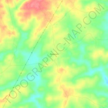
Name: Simpson topographic map, elevation, terrain.

Location: Simpson, Tallapoosa County, Alabama, 36256, United States (33.05179 -85.74190 33.09179 -85.70190)

Average elevation: 237 m

Minimum elevation: 198 m

Maximum elevation: 281 m

Other topographic maps

Click on a map to view its topography, its elevation and its terrain.

Gear up for your next adventure:

🥾Mountain Hiking Shoes - Shoes with superior grip for mountainous terrain
🥾Waterproof Hiking Shoes - Durable shoes for wet and rugged trails
🥾Lightweight Hiking Shoes - Comfortable shoes for day hikes
🔭Outdoor Binoculars - Lightweight binoculars for birdwatching and hiking
🥾Trail Hiking Shoes - Durable shoes designed for rugged trails

As an Amazon Associate, this site earns from qualifying purchases at no extra cost to you.