Geolocate

Tutira topographic map

Click on the map to display elevation.

About this map

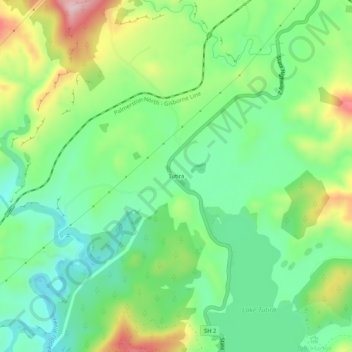
Name: Tutira topographic map, elevation, terrain.

Location: Tutira, Hastings District, Hawke's Bay, New Zealand (-39.22745 176.86119 -39.18745 176.90119)

Average elevation: 191 m

Minimum elevation: 89 m

Maximum elevation: 384 m

Other topographic maps

Click on a map to view its topography, its elevation and its terrain.

Kaweka Range

New Zealand > Hawke's Bay > Hastings District

Average elevation: 1,138 m

Gear up for your next adventure:

🥾Mountain Hiking Shoes - Shoes with superior grip for mountainous terrain
🧥Waterproof Jacket - Lightweight rain jackets for hiking and outdoor activities
🧢Hiking Hat - Sun-protective and breathable hats for long treks
🦯Trekking Poles - Reduced impact on joints for steep topographic climbs
🧦Hiking Liner Socks - Thin base layer to prevent friction and blisters

As an Amazon Associate, this site earns from qualifying purchases at no extra cost to you.