
Passo dello Stelvio topographic map
Click on the map to display elevation.
Passo dello Stelvio
The Stelvio Pass (Italian: Passo dello Stelvio [passo ˈdello ˈstɛlvjo], Giogo dello Stelvio [dʒɔgo ˈdello ˈstɛlvjo]; German: Stilfser Joch; [ˈʃtɪlfsɐ jɔx]) is a mountain pass in northern Italy bordering Switzerland at an elevation of 2,757 m (9,045 ft) above sea level. It is the highest paved mountain pass in the Eastern Alps, and the second highest in the Alps, 7 m (23 ft) below France's Col de l'Iseran (2,764 m (9,068 ft)).
About this map
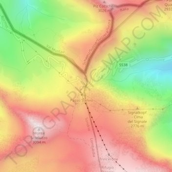
Name: Passo dello Stelvio topographic map, elevation, terrain.
Average elevation: 2,724 m
Minimum elevation: 2,261 m
Maximum elevation: 3,075 m