Geolocate

Amlidih topographic map

Click on the map to display elevation.

About this map

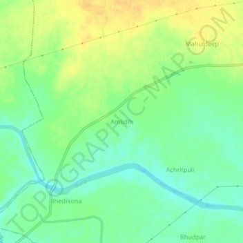
Name: Amlidih topographic map, elevation, terrain.

Location: Amlidih, Malkharoda Tahsil, Sakti, Chhattisgarh, India (21.76054 82.93421 21.80054 82.97421)

Average elevation: 216 m

Minimum elevation: 203 m

Maximum elevation: 229 m

Gear up for your next adventure:

🧥Fleece Jacket - Warm and lightweight jacket for layering
🎒Hiking Backpack - Lightweight and ergonomic backpacks for day hikes or multi-day treks
🧢Sun Protection Cap - Breathable cap to protect from sun exposure
📷Outdoor Action Camera - Capture high-elevation views and rugged adventures
🥫Freeze-Dried Meals - Lightweight, high-calorie nutrition for multi-day treks

As an Amazon Associate, this site earns from qualifying purchases at no extra cost to you.