Geolocate

桥上 topographic map

Interactive map

Click on the map to display elevation.

About this map

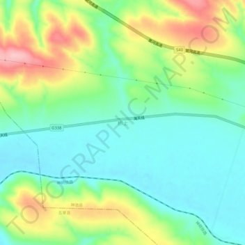
Name: 桥上 topographic map, elevation, terrain.

Location: 桥上, 神池县, 忻州市, 山西省, 中国 (39.11089 111.75293 39.15089 111.79293)

Average elevation: 1,373 m

Minimum elevation: 1,319 m

Maximum elevation: 1,475 m

Other topographic maps

Click on a map to view its topography, its elevation and its terrain.

温岭

中国 > 山西省 > 神池县

温岭, 神池县, 忻州市, 山西省, 中国

Average elevation: 1,564 m

龙元村

中国 > 山西省 > 神池县

龙元村, 神池县, 忻州市, 山西省, 中国

Average elevation: 1,476 m

神池县

中国 > 山西省 > 神池县

神池县, 忻州市, 山西省, 中国

Average elevation: 1,595 m

马坊

中国 > 山西省 > 神池县

马坊, 神池县, 忻州市, 山西省, 中国

Average elevation: 1,665 m