Geolocate

Wolbach topographic map

Click on the map to display elevation.

About this map

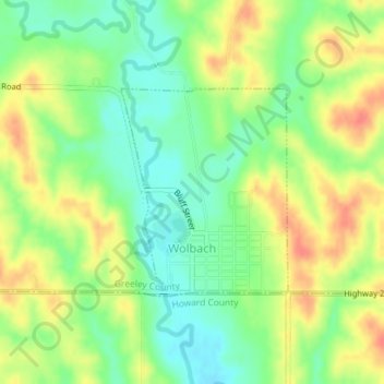
Name: Wolbach topographic map, elevation, terrain.

Location: Wolbach, Greeley County, Nebraska, United States (41.39364 -98.40280 41.40824 -98.38711)

Average elevation: 582 m

Minimum elevation: 557 m

Maximum elevation: 611 m

Gear up for your next adventure:

🧢Beanie Hat - Keep your head warm in cold weather
🪑Ultralight Camping Stool - Compact seating for rest stops during long hikes
🦶Anti-Blister Balm - Prevents friction and hotspots during long ascents
🛰️Satellite Messenger - Emergency communication for areas with no cell service
🔥Camping Stove - Portable stoves to cook outdoors with ease

As an Amazon Associate, this site earns from qualifying purchases at no extra cost to you.