
Koula topographic map
Interactive map
Click on the map to display elevation.
About this map
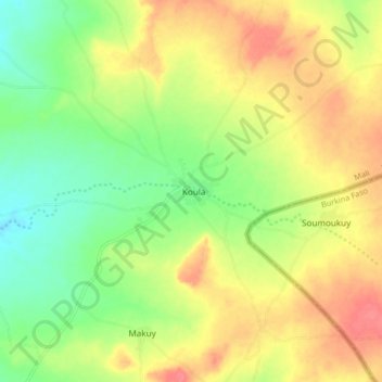
Name: Koula topographic map, elevation, terrain.
Location: Koula, Cercle de Tominian, Ségou, Mali (13.20405 -4.31168 13.28405 -4.23168)
Average elevation: 385 m
Minimum elevation: 353 m
Maximum elevation: 417 m
Other topographic maps
Click on a map to view its topography, its elevation and its terrain.