Geolocate

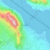
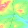
Ballinteskin topographic map

Click on the map to display elevation.

About this map

Name: Ballinteskin topographic map, elevation, terrain.

Location: Ballinteskin, Drummullagh ED, The Municipal District of Dundalk, County Louth, Leinster, Ireland (54.05649 -6.27049 54.07914 -6.24456)

Average elevation: 170 m

Minimum elevation: 0 m

Maximum elevation: 505 m

Other topographic maps

Click on a map to view its topography, its elevation and its terrain.
Drogheda

Ireland > County Louth > Drogheda

Average elevation: 38 m

Carlingford

Ireland > County Louth > Carlingford

Average elevation: 84 m

Dundalk

Ireland > County Louth > Dundalk

Average elevation: 16 m

Blackrock

Ireland > County Louth

Average elevation: 5 m

Dromiskin

Ireland > County Louth > Dromiskin

Average elevation: 8 m

Collon

Ireland > County Louth > Collon

Average elevation: 146 m

Brookville Park

Ireland > County Louth

Average elevation: 26 m

Louth

Ireland > County Louth

Average elevation: 34 m

Tullyallen

Ireland > County Louth

Average elevation: 64 m

Slieve Foye

Ireland > County Louth

Average elevation: 287 m

Ravensdale

Ireland > County Louth

Average elevation: 124 m

Gear up for your next adventure:

🧢Beanie Hat - Keep your head warm in cold weather
🧰Emergency Multi-Tool - Compact multi-tool for outdoor survival
🥾Waterproof Hiking Boots - Essential footwear for rugged terrain and wet Canadian trails
🎒Backpack Rain Cover - External shield to keep your entire pack dry
🥾Mountain Trail Shoes - High-traction shoes for mountain trails

As an Amazon Associate, this site earns from qualifying purchases at no extra cost to you.