
Darton topographic map
Interactive map
Click on the map to display elevation.
About this map
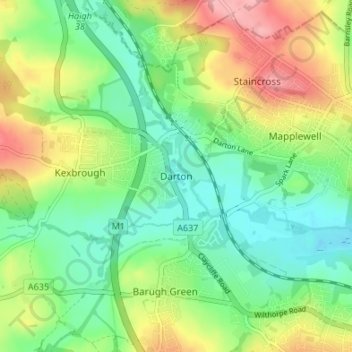
Name: Darton topographic map, elevation, terrain.
Average elevation: 91 m
Minimum elevation: 47 m
Maximum elevation: 165 m
Darton lies on the River Dearne, directly to the east of Kexbrough, and is situated about 1 mile (1.6 km) west of Mapplewell, 5 miles (8 km) north of Barnsley, 9 miles (14 km) south-west of Wakefield, 14 miles (23 km) south-east of Huddersfield, 19 miles (31 km) south of Leeds, and 21 miles (34 km) north of Sheffield. It is served by the A637 road and is bisected by the M1 motorway (junction 38 being a mile to the north). Its location is approximately 53°35′6″N 1°31′57″W / 53.58500°N 1.53250°W / 53.58500; -1.53250, at an elevation of around 260 feet (79 m) above mean sea level.