
Thank you for supporting this site ❤️
Make a donation
Make a donation
Gear up for your next adventure:
As an Amazon Associate, this site earns from qualifying purchases at no extra cost to you.
Chorzów topographic map
Click on the map to display elevation.
Thank you for supporting this site ❤️
Make a donation
Make a donation
Gear up for your next adventure:
As an Amazon Associate, this site earns from qualifying purchases at no extra cost to you.
About this map
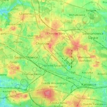
Name: Chorzów topographic map, elevation, terrain.
Location: Chorzów, Metropolis GZM, Silesian Voivodeship, Poland (50.23910 18.91896 50.33786 19.00683)
Average elevation: 283 m
Minimum elevation: 248 m
Maximum elevation: 332 m
Thank you for supporting this site ❤️
Make a donation
Make a donation
Gear up for your next adventure:
As an Amazon Associate, this site earns from qualifying purchases at no extra cost to you.