
Shelocta topographic map
Click on the map to display elevation.
About this map
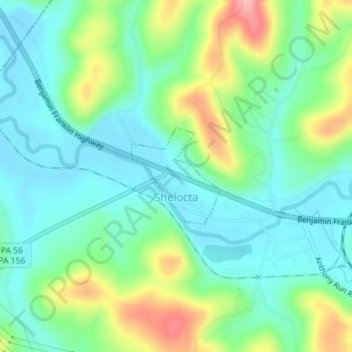
Name: Shelocta topographic map, elevation, terrain.
Location: Shelocta, Indiana County, Pennsylvania, United States (40.65379 -79.30656 40.66124 -79.29752)
Average elevation: 340 m
Minimum elevation: 299 m
Maximum elevation: 437 m
Other topographic maps
Click on a map to view its topography, its elevation and its terrain.
Dilltown
United States > Pennsylvania > Indiana County > East Wheatfield Township
Average elevation: 474 m
Robinson
United States > Pennsylvania > Indiana County > West Wheatfield Township
Average elevation: 397 m