Geolocate

Mumias topographic map

Click on the map to display elevation.

About this map

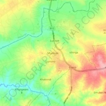
Name: Mumias topographic map, elevation, terrain.

Location: Mumias, Mumias Central ward, Mumias West, Kakamega County, Kenya (0.29611 34.44954 0.37611 34.52954)

Average elevation: 1,301 m

Minimum elevation: 1,245 m

Maximum elevation: 1,372 m

Gear up for your next adventure:

🧴Outdoor Sunscreen - High SPF protection for high-altitude UV exposure
Lightweight Backpacking Tent - Compact tent for efficient hiking trips
🥾Trail Hiking Shoes - Durable shoes designed for rugged trails
🥾Lightweight Hiking Boots - Boots for comfort and mobility on long hikes
👖Convertible Hiking Pants - Zip-off legs to adapt to changing weather conditions

As an Amazon Associate, this site earns from qualifying purchases at no extra cost to you.