Geolocate

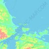
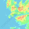
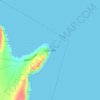
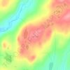
Comfort Cove-Newstead topographic map

Click on the map to display elevation.

About this map

Name: Comfort Cove-Newstead topographic map, elevation, terrain.

Location: Comfort Cove-Newstead, Newfoundland, Newfoundland and Labrador, Canada (49.30243 -54.94315 49.41980 -54.81426)

Average elevation: 6 m

Minimum elevation: -1 m

Maximum elevation: 83 m

Other topographic maps

Click on a map to view its topography, its elevation and its terrain.
Labrador

Canada > Newfoundland and Labrador

Average elevation: 674 m

Englee

Canada > Newfoundland and Labrador > Englee

Average elevation: 34 m

Mount Caubvick

Canada > Newfoundland and Labrador

Average elevation: 1,272 m

Bridgeport

Canada > Newfoundland and Labrador

Average elevation: 22 m

Monroe

Canada > Newfoundland and Labrador

Average elevation: 41 m

Smokey

Canada > Newfoundland and Labrador > Smokey

Average elevation: 14 m

Tims Hill

Canada > Newfoundland and Labrador

Average elevation: 126 m

Gear up for your next adventure:

🧦Merino Wool Socks - Moisture-wicking comfort for long-distance hiking
🗺️Topographic Maps - Detailed maps to explore trails, mountains, and wilderness areas
🚲MTB Frame Bag - Carry tools and maps directly on your bicycle frame
🧭GPS Handheld Device - Reliable GPS navigation for outdoor adventures
🔪Outdoor Multitool - Versatile tool for repairs and food prep in the wild

As an Amazon Associate, this site earns from qualifying purchases at no extra cost to you.