Geolocate

Lemek topographic map

Click on the map to display elevation.

About this map

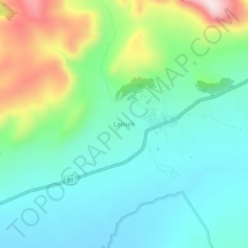
Name: Lemek topographic map, elevation, terrain.

Location: Lemek, Mara ward, Narok West, Narok, Kenya (-1.12000 35.36330 -1.08000 35.40330)

Average elevation: 1,968 m

Minimum elevation: 1,860 m

Maximum elevation: 2,251 m

Gear up for your next adventure:

Backpacking Tent - Lightweight tent for long-distance hiking trips
🍽️Titanium Camping Spork - Ultralight and indestructible eating utensil
🧥Softshell Hiking Jacket - The perfect balance of wind protection and breathability
🥾Trekking Poles - Adjustable trekking poles to reduce knee stress and improve stability
🧭Orienteering Kit - Tools for map reading and navigation in the wild

As an Amazon Associate, this site earns from qualifying purchases at no extra cost to you.