Geolocate

Santa Lucia topographic map

Click on the map to display elevation.

About this map

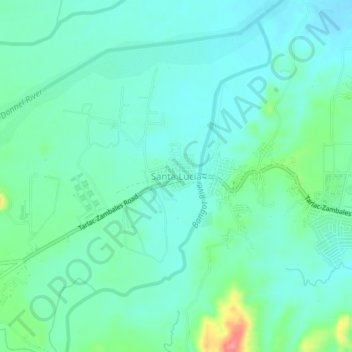
Name: Santa Lucia topographic map, elevation, terrain.

Location: Santa Lucia, Capas, Tarlac, Central Luzon, 2315, Philippines (15.34861 120.46562 15.38861 120.50562)

Average elevation: 110 m

Minimum elevation: 91 m

Maximum elevation: 174 m

Other topographic maps

Click on a map to view its topography, its elevation and its terrain.

Tambo Lake

Philippines > Tarlac > Capas

Average elevation: 292 m

Gear up for your next adventure:

🧢Outdoor Cap - Protective cap for sun and rain during hikes
🧣Merino Neck Gaiter - Protects against wind, sun, and cold at high altitudes
🛶Kayak Accessories - Essential gear for safe and fun kayaking adventures
🌬️Windproof Camp Stove - Efficient cooking even on exposed mountain peaks
🧦Merino Wool Socks - Moisture-wicking comfort for long-distance hiking

As an Amazon Associate, this site earns from qualifying purchases at no extra cost to you.