Geolocate

Carbayín topographic map

Click on the map to display elevation.

About this map

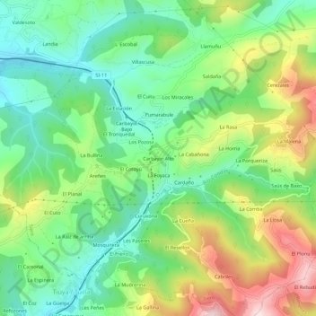
Name: Carbayín topographic map, elevation, terrain.

Location: Carbayín, Santiago Arenas, Siero, Asturias, 33936, España (43.32551 -5.64884 43.36551 -5.60884)

Average elevation: 370 m

Minimum elevation: 222 m

Maximum elevation: 629 m

Other topographic maps

Click on a map to view its topography, its elevation and its terrain.

San Juan Arenas

España > Asturias > Siero

Average elevation: 334 m

Santiago Arenas

España > Asturias > Siero

Average elevation: 400 m

Collado

España > Asturias > Siero

Average elevation: 288 m

Gear up for your next adventure:

🥾Trail Hiking Socks - Comfortable socks to prevent blisters and fatigue
🧴Sunscreen SPF - Broad-spectrum sunscreen for outdoor activities
🪑Insulated Seat Pad - Protect your seat from cold rocks and wet logs
🛏️Sleeping Bag - Warm and compact sleeping bags for outdoor camping
🪑Ultralight Camping Stool - Compact seating for rest stops during long hikes

As an Amazon Associate, this site earns from qualifying purchases at no extra cost to you.