Geolocate

Villamont topographic map

Click on the map to display elevation.

About this map

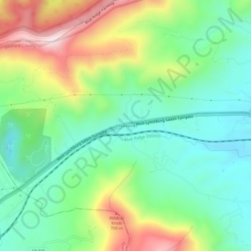
Name: Villamont topographic map, elevation, terrain.

Location: Villamont, Bedford County, Virginia, 24064, United States (37.37541 -79.79615 37.41541 -79.75615)

Average elevation: 485 m

Minimum elevation: 321 m

Maximum elevation: 792 m

Other topographic maps

Click on a map to view its topography, its elevation and its terrain.

Elk Creek

United States > Virginia > Bedford County

Average elevation: 220 m

Bedford

United States > Virginia > Bedford County

Average elevation: 285 m

Gear up for your next adventure:

🥾Mountain Hiking Boots - High-traction boots for rocky terrain
🚲MTB Frame Bag - Carry tools and maps directly on your bicycle frame
🥾Hiking Shoes - Durable and comfortable shoes for trail hiking
🔦LED Headtorch - Bright and durable light for night activities
🦌Outdoor Trail Camera - Monitor wildlife activity near your favorite spots

As an Amazon Associate, this site earns from qualifying purchases at no extra cost to you.