Geolocate

Wamena topographic map

Click on the map to display elevation.

About this map

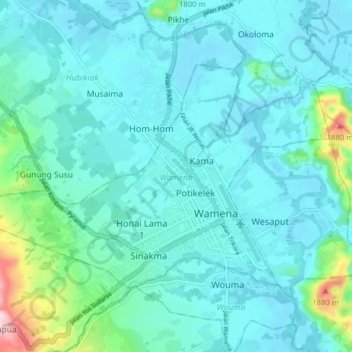
Name: Wamena topographic map, elevation, terrain.

Location: Wamena, Jayawijaya, Highland Papua, 99511, Indonesia (-4.11123 138.89302 -4.06077 138.97249)

Average elevation: 1,678 m

Minimum elevation: 1,634 m

Maximum elevation: 1,940 m

Gear up for your next adventure:

🔋Emergency Crank Radio - Weather alerts and power without needing batteries
🏕️Camping Hammock - Integrated protection for sleeping between trees
📷Outdoor Action Camera - Capture high-elevation views and rugged adventures
🎒Hiking Backpack - Lightweight and ergonomic backpacks for day hikes or multi-day treks
🧤Rechargeable Heated Gloves - Extreme warmth for Canadian winter expeditions

As an Amazon Associate, this site earns from qualifying purchases at no extra cost to you.