
Thank you for supporting this site ❤️
Make a donation
Make a donation
Gear up for your next adventure:
As an Amazon Associate, this site earns from qualifying purchases at no extra cost to you.
Wamena topographic map
Click on the map to display elevation.
Thank you for supporting this site ❤️
Make a donation
Make a donation
Gear up for your next adventure:
As an Amazon Associate, this site earns from qualifying purchases at no extra cost to you.
About this map
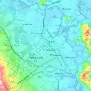
Name: Wamena topographic map, elevation, terrain.
Location: Wamena, Jayawijaya, Highland Papua, 99511, Indonesia (-4.11123 138.89302 -4.06077 138.97249)
Average elevation: 1,678 m
Minimum elevation: 1,634 m
Maximum elevation: 1,940 m
Thank you for supporting this site ❤️
Make a donation
Make a donation
Gear up for your next adventure:
As an Amazon Associate, this site earns from qualifying purchases at no extra cost to you.