Geolocate

Dunmor topographic map

Click on the map to display elevation.

About this map
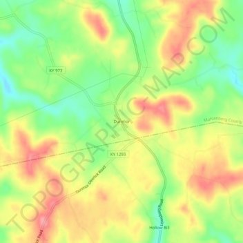
Name: Dunmor topographic map, elevation, terrain.

Location: Dunmor, Muhlenberg County, Kentucky, 42339, United States (37.05366 -87.01611 37.09366 -86.97611)

Average elevation: 179 m

Minimum elevation: 132 m

Maximum elevation: 223 m

Other topographic maps

Click on a map to view its topography, its elevation and its terrain.

Drakesboro

United States > Kentucky > Muhlenberg County

Average elevation: 131 m

Greenville

United States > Kentucky > Muhlenberg County

Average elevation: 149 m

Gear up for your next adventure:

🥾Trail Hiking Socks - Comfortable socks to prevent blisters and fatigue
🥾Trail Hiking Shoes - Durable shoes designed for rugged trails
🛶Kayak Dry Bag - Waterproof storage for kayaking adventures
💡LED Headlamp - Hands-free illumination for night hiking and camping
🧢Outdoor Visor - Breathable visor for sunny hikes

As an Amazon Associate, this site earns from qualifying purchases at no extra cost to you.