Geolocate

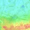
Sustrum topographic map

Click on the map to display elevation.

About this map

Name: Sustrum topographic map, elevation, terrain.

Location: Sustrum, Samtgemeinde Lathen, Landkreis Emsland, Nedersaksen, Duitsland (52.87976 7.12007 52.92319 7.31313)

Average elevation: 10 m

Minimum elevation: 2 m

Maximum elevation: 22 m

Other topographic maps

Click on a map to view its topography, its elevation and its terrain.

Gleesen

Duitsland > Nedersaksen > Landkreis Emsland

Average elevation: 29 m

Neusustrum

Duitsland > Nedersaksen > Landkreis Emsland

Average elevation: 11 m

Hesselte

Duitsland > Nedersaksen > Landkreis Emsland > Emsbüren

Average elevation: 31 m

Sprakel

Duitsland > Nedersaksen > Landkreis Emsland > Stavern

Average elevation: 39 m

Sand

Duitsland > Nedersaksen > Landkreis Emsland > Oberlangen

Average elevation: 10 m

Haar

Duitsland > Nedersaksen > Landkreis Emsland > Haren (Ems)

Average elevation: 15 m

Gear up for your next adventure:

🏃Hydration Running Vest - Carry water and maps close to your body for speed
🥾Trail Hiking Socks - Comfortable socks to prevent blisters and fatigue
🥾Lightweight Hiking Boots - Boots for comfort and mobility on long hikes
🧢Hiking Sun Hat - Wide-brimmed protection for exposed mountain ridges
🚲Heavy Duty Bike Lock - Secure your bike at the trailhead or during stops

As an Amazon Associate, this site earns from qualifying purchases at no extra cost to you.