Geolocate

Heiligenrode topographic map

Click on the map to display elevation.

About this map

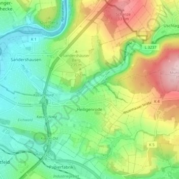
Name: Heiligenrode topographic map, elevation, terrain.

Location: Heiligenrode, Niestetal, Landkreis Kassel, Hesse, 34266, Germany (51.29144 9.55927 51.33375 9.63929)

Average elevation: 213 m

Minimum elevation: 131 m

Maximum elevation: 361 m

Gear up for your next adventure:

🚲Bike Repair Kit - Essential tools for on-trail mechanical issues
🧥Waterproof Pants - Keep dry during rainy hiking conditions
🥾Waterproof Hiking Boots - Boots keeping your feet dry in wet conditions
🔪Outdoor Multitool - Versatile tool for repairs and food prep in the wild
🔥Emergency Fire Starter - Reliable ignition source for all weather conditions

As an Amazon Associate, this site earns from qualifying purchases at no extra cost to you.