
Thank you for supporting this site ❤️
Make a donation
Make a donation
Gear up for your next adventure:
As an Amazon Associate, this site earns from qualifying purchases at no extra cost to you.
Aveleira topographic map
Click on the map to display elevation.
Thank you for supporting this site ❤️
Make a donation
Make a donation
Gear up for your next adventure:
As an Amazon Associate, this site earns from qualifying purchases at no extra cost to you.
About this map
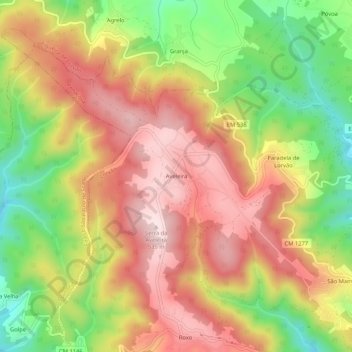
Name: Aveleira topographic map, elevation, terrain.
Location: Aveleira, Lorvão, Penacova, Coimbra, 3360-054, Portugal (40.24391 -8.36676 40.28391 -8.32676)
Average elevation: 373 m
Minimum elevation: 176 m
Maximum elevation: 536 m
Thank you for supporting this site ❤️
Make a donation
Make a donation
Gear up for your next adventure:
As an Amazon Associate, this site earns from qualifying purchases at no extra cost to you.