Geolocate

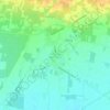
Pontelatone topographic map

Click on the map to display elevation.

About this map

Name: Pontelatone topographic map, elevation, terrain.

Location: Pontelatone, Caserta, Campania, Italia (41.13257 14.22070 41.25099 14.30558)

Average elevation: 274 m

Minimum elevation: 17 m

Maximum elevation: 998 m

Other topographic maps

Click on a map to view its topography, its elevation and its terrain.

Destra Volturno

Italia > Campania > Caserta > Castel Volturno

Average elevation: 1 m

Borgo Appio

Italia > Campania > Caserta > Grazzanise

Average elevation: 8 m

Sant'Andrea del Pizzone

Italia > Campania > Caserta

Average elevation: 15 m

Casola

Italia > Campania > Caserta > Caserta

Average elevation: 317 m

Pugliano

Italia > Campania > Caserta > Teano

Average elevation: 189 m

Sant'Agata

Italia > Campania > Caserta > Sessa Aurunca > Avezzano-Sorbello

Average elevation: 190 m

Vallelunga

Italia > Campania > Caserta > Gallo Matese

Average elevation: 783 m

Sepicciano

Italia > Campania > Caserta > Piedimonte Matese > Sepicciano

Average elevation: 315 m

Pellegrino

Italia > Campania > Caserta > Pontelatone

Average elevation: 194 m

Mezzano

Italia > Campania > Caserta > Caserta

Average elevation: 207 m

Gear up for your next adventure:

🥾Trail Hiking Boots - Supportive boots for rough trails
🦌Outdoor Trail Camera - Monitor wildlife activity near your favorite spots
🥾Trail Running Shoes - Lightweight and durable shoes for trail running
🥘Camping Cookware Set - Compact nesting pots and pans for trail cooking
🥾Trekking Boots - Durable boots for long-distance trekking

As an Amazon Associate, this site earns from qualifying purchases at no extra cost to you.