Geolocate

El Palo topographic map

Click on the map to display elevation.

About this map

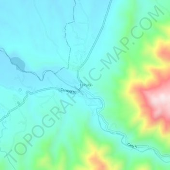
Name: El Palo topographic map, elevation, terrain.

Location: El Palo, Caloto, Norte, Cauca, RAP Pacífico, Colombia (3.04667 -76.37256 3.08667 -76.33256)

Average elevation: 1,160 m

Minimum elevation: 1,037 m

Maximum elevation: 1,606 m

Gear up for your next adventure:

🥾Trail Hiking Shoes - Durable shoes designed for rugged trails
🧦Hiking Liner Socks - Thin base layer to prevent friction and blisters
🥾Hiking Shoes - Durable and comfortable shoes for trail hiking
🎒Hiking Backpack - Lightweight and ergonomic backpacks for day hikes or multi-day treks
🚑Survival Whistle - Signal for help across long distances in mountains

As an Amazon Associate, this site earns from qualifying purchases at no extra cost to you.