Make a donation
Gear up for your next adventure:
As an Amazon Associate, this site earns from qualifying purchases at no extra cost to you.
Ray topographic map
Click on the map to display elevation.
Make a donation
Gear up for your next adventure:
As an Amazon Associate, this site earns from qualifying purchases at no extra cost to you.
Ray
Ray is an unincorporated community in both Steuben County, Indiana and Branch County, Michigan in the United States. Located along the local "State Line Road," the small community straddles the border between the two states. The Indiana Northeastern Railroad travels southwest-northeast through Ray. Its elevation is 1,079 feet (329 m), making it the highest populated place in northern Indiana.
Make a donation
Gear up for your next adventure:
As an Amazon Associate, this site earns from qualifying purchases at no extra cost to you.
About this map
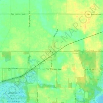
Name: Ray topographic map, elevation, terrain.
Average elevation: 328 m
Minimum elevation: 314 m
Maximum elevation: 339 m
Make a donation
Gear up for your next adventure:
As an Amazon Associate, this site earns from qualifying purchases at no extra cost to you.
Other topographic maps
Click on a map to view its topography, its elevation and its terrain.
Make a donation
Gear up for your next adventure:
As an Amazon Associate, this site earns from qualifying purchases at no extra cost to you.
Make a donation
Gear up for your next adventure:
As an Amazon Associate, this site earns from qualifying purchases at no extra cost to you.
