Geolocate

Lignum topographic map

Click on the map to display elevation.

About this map

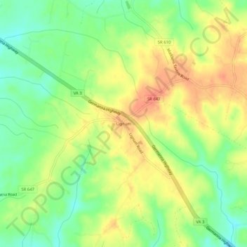
Name: Lignum topographic map, elevation, terrain.

Location: Lignum, Culpeper County, Virginia, 22726, United States (38.39596 -77.84666 38.43596 -77.80666)

Average elevation: 106 m

Minimum elevation: 80 m

Maximum elevation: 131 m

Other topographic maps

Click on a map to view its topography, its elevation and its terrain.

Hazel River

United States > Virginia > Culpeper County

Average elevation: 91 m

Gear up for your next adventure:

🧥Waterproof Pants - Keep dry during rainy hiking conditions
🧦Merino Wool Socks - Moisture-wicking comfort for long-distance hiking
🧦Hiking Liner Socks - Thin base layer to prevent friction and blisters
👖Convertible Hiking Pants - Zip-off legs to adapt to changing weather conditions
💧Hydration Pack - Hands-free hydration system for long hikes

As an Amazon Associate, this site earns from qualifying purchases at no extra cost to you.