
Thank you for supporting this site ❤️
Make a donation
Make a donation
Gear up for your next adventure:
As an Amazon Associate, this site earns from qualifying purchases at no extra cost to you.
Gutenswil topographic map
Click on the map to display elevation.
Thank you for supporting this site ❤️
Make a donation
Make a donation
Gear up for your next adventure:
As an Amazon Associate, this site earns from qualifying purchases at no extra cost to you.
About this map
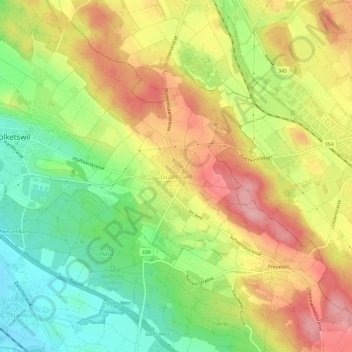
Name: Gutenswil topographic map, elevation, terrain.
Location: Gutenswil, Volketswil, Bezirk Uster, Zurich, 8605, Switzerland (47.36540 8.69805 47.40540 8.73805)
Average elevation: 519 m
Minimum elevation: 448 m
Maximum elevation: 591 m
Thank you for supporting this site ❤️
Make a donation
Make a donation
Gear up for your next adventure:
As an Amazon Associate, this site earns from qualifying purchases at no extra cost to you.