
Make a donation
Gear up for your next adventure:
As an Amazon Associate, this site earns from qualifying purchases at no extra cost to you.
Babelsberg topographic map
Click on the map to display elevation.
Make a donation
Gear up for your next adventure:
As an Amazon Associate, this site earns from qualifying purchases at no extra cost to you.
About this map
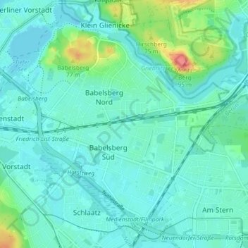
Name: Babelsberg topographic map, elevation, terrain.
Location: Babelsberg, Potsdam, Teltow, Brandenburg, Deutschland (52.37039 13.07440 52.41380 13.13895)
Average elevation: 41 m
Minimum elevation: 29 m
Maximum elevation: 90 m
Make a donation
Gear up for your next adventure:
As an Amazon Associate, this site earns from qualifying purchases at no extra cost to you.
Other topographic maps
Click on a map to view its topography, its elevation and its terrain.
Potsdam
Deutschland > Brandenburg > Potsdam
In Potsdam herrscht ein gemäßigtes Klima, das sowohl von Norden und Westen her vom atlantischen Klima als auch vom kontinentalen Klima aus Osten beeinflusst wird. Wetterextreme wie Stürme, starker Hagel oder starke Schneefälle sind selten. Der Temperaturverlauf entspricht ungefähr dem bundesdeutschen…
Average elevation: 43 m
Brauhausberg
Deutschland > Brandenburg > Potsdam
Ein gutes Jahrhundert nach der Königsbrauerei ließen sich die Braumeister Adelung und Hoffmann ganz in der Nähe eine eigene Brauerei errichten und erzeugten ab 1829 die Biersorte Potsdamer Stangenbier. Familie Hoffmann erwarb darüber hinaus das Kolonistenhaus Nummer 2 in der damaligen Schützenstraße und…
Average elevation: 45 m
Make a donation
Gear up for your next adventure:
As an Amazon Associate, this site earns from qualifying purchases at no extra cost to you.