Geolocate

Clarksburg topographic map

Click on the map to display elevation.

About this map

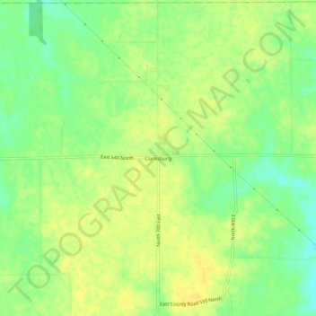
Name: Clarksburg topographic map, elevation, terrain.

Location: Clarksburg, Decatur County, Indiana, 47225, United States (39.41338 -85.36774 39.45338 -85.32774)

Average elevation: 321 m

Minimum elevation: 306 m

Maximum elevation: 330 m

Other topographic maps

Click on a map to view its topography, its elevation and its terrain.

Lake Santee

United States > Indiana > Decatur County

Average elevation: 307 m

St. Paul

United States > Indiana > Decatur County

Average elevation: 258 m

Westport

United States > Indiana > Decatur County

Average elevation: 249 m

Millhousen

United States > Indiana > Decatur County

Average elevation: 277 m

New Point

United States > Indiana > Decatur County

Average elevation: 301 m

Gear up for your next adventure:

🧥Waterproof Hiking Jacket - Protect yourself from rain and wind while hiking
🚲Handlebar Phone Mount - View topographic-map.com live while cycling
🍽️Titanium Camping Spork - Ultralight and indestructible eating utensil
🥾Approach Boots - Comfortable boots for hiking and climbing approaches
🛁Quick-Dry Microfiber Towel - Space-saving towel that dries rapidly on the move

As an Amazon Associate, this site earns from qualifying purchases at no extra cost to you.