
Make a donation
Gear up for your next adventure:
As an Amazon Associate, this site earns from qualifying purchases at no extra cost to you.
Vienna Basin topographic map
Click on the map to display elevation.
Make a donation
Gear up for your next adventure:
As an Amazon Associate, this site earns from qualifying purchases at no extra cost to you.
Vienna Basin
The Vienna Basin (German: Wiener Becken, Czech: Vídeňská pánev, Slovak: Viedenská kotlina, Hungarian: Bécsi-medence) is a geologically young tectonic burial basin and sedimentary basin in the seam area between the Alps, the Carpathians and the Pannonian Plain. Although it topographically separates the Alps from the Western Carpathians, it connects them geologically via corresponding rocks underground.
Make a donation
Gear up for your next adventure:
As an Amazon Associate, this site earns from qualifying purchases at no extra cost to you.
About this map
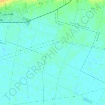
Name: Vienna Basin topographic map, elevation, terrain.
Average elevation: 166 m
Minimum elevation: 160 m
Maximum elevation: 188 m
Make a donation
Gear up for your next adventure:
As an Amazon Associate, this site earns from qualifying purchases at no extra cost to you.