Geolocate

Millville topographic map

Click on the map to display elevation.

About this map

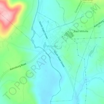
Name: Millville topographic map, elevation, terrain.

Location: Millville, Columbia County, Pennsylvania, United States (41.10600 -76.53703 41.13178 -76.51540)

Average elevation: 225 m

Minimum elevation: 181 m

Maximum elevation: 368 m

Gear up for your next adventure:

🛶Kayak Accessories - Essential gear for safe and fun kayaking adventures
🦟Insect Repellent - Keep mosquitoes and black flies away in wooded areas
🛌Down Sleeping Bag - Superior warmth-to-weight ratio for cold nights
🎒Hiking Backpack - Lightweight and ergonomic backpacks for day hikes or multi-day treks
🧥Waterproof Jacket - Lightweight rain jackets for hiking and outdoor activities

As an Amazon Associate, this site earns from qualifying purchases at no extra cost to you.