
Thank you for supporting this site ❤️
Make a donation
Make a donation
Gear up for your next adventure:
As an Amazon Associate, this site earns from qualifying purchases at no extra cost to you.
Termopilas topographic map
Click on the map to display elevation.
Thank you for supporting this site ❤️
Make a donation
Make a donation
Gear up for your next adventure:
As an Amazon Associate, this site earns from qualifying purchases at no extra cost to you.
About this map
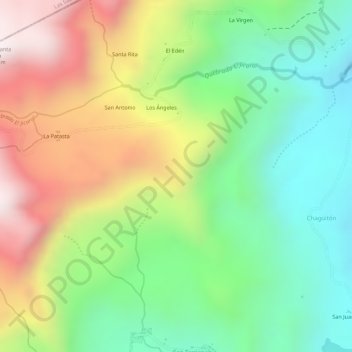
Name: Termopilas topographic map, elevation, terrain.
Location: Termopilas, Pueblo Nuevo, Estelí, 32200, Nicaragua (13.31668 -86.59706 13.33668 -86.57706)
Average elevation: 1,289 m
Minimum elevation: 997 m
Maximum elevation: 1,665 m
Thank you for supporting this site ❤️
Make a donation
Make a donation
Gear up for your next adventure:
As an Amazon Associate, this site earns from qualifying purchases at no extra cost to you.