Geolocate

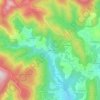
Baillargues topographic map

Click on the map to display elevation.

About this map

Name: Baillargues topographic map, elevation, terrain.

Location: Baillargues, Montpellier, Hérault, Occitania, Metropolitan France, 34670, France (43.63894 3.98613 43.67387 4.03478)

Average elevation: 27 m

Minimum elevation: 8 m

Maximum elevation: 59 m

Other topographic maps

Click on a map to view its topography, its elevation and its terrain.
Le Faubourg

France > Occitania > Hérault > Béziers

Average elevation: 33 m

L'Horte

France > Occitania > Hérault > Taussac-la-Billière

Average elevation: 393 m

Gear up for your next adventure:

🧴Sunscreen SPF - Broad-spectrum sunscreen for outdoor activities
🦌Outdoor Trail Camera - Monitor wildlife activity near your favorite spots
🥾Trail Hiking Shoes - Durable shoes designed for rugged trails
🥾Hiking Shoes - Durable and comfortable shoes for trail hiking
🗺️Topographic Maps - Detailed maps to explore trails, mountains, and wilderness areas

As an Amazon Associate, this site earns from qualifying purchases at no extra cost to you.