
Luya topographic map
Interactive map
Click on the map to display elevation.
About this map
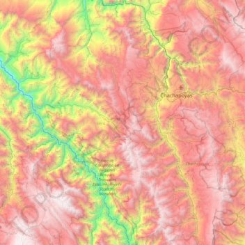
Name: Luya topographic map, elevation, terrain.
Location: Luya, Amazonas, Pérou (-6.74591 -78.41973 -5.90256 -77.80202)
Average elevation: 2,428 m
Minimum elevation: 541 m
Maximum elevation: 3,965 m
Other topographic maps
Click on a map to view its topography, its elevation and its terrain.
Mendoza
Pérou > Amazonas > San Nicolás
Mendoza, San Nicolás, Rodríguez de Mendoza, Amazonas, Pérou
Average elevation: 1,829 m
Catarata Gocta
Pérou > Amazonas > San Carlos
Catarata Gocta, San Carlos, Bongará, Amazonas, Pérou
Average elevation: 2,521 m